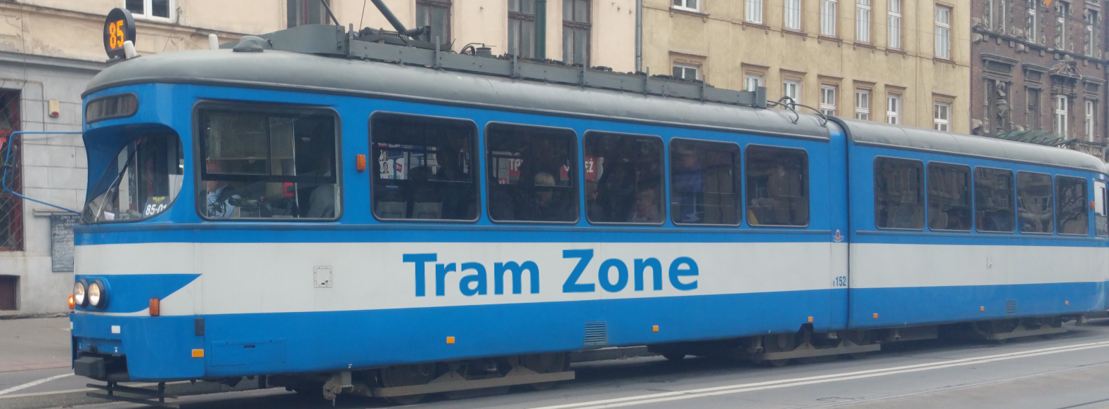
Tram systems in Melbourne
Melbourne is the capital of the Australian state of Victoria and one of Australia's two largest cities. Greater Melbourne has a population of more than five million and extends around the northern and eastern shores of Port Phillip.
The city was established beside the lower reaches of the Yarra River, known as Birrarung to its Traditional Owners. Rapid growth following the Victorian gold rush transformed Melbourne into a major commercial centre, leaving a legacy of nineteenth-century buildings, broad boulevards, public gardens and an extensive inner-city street grid.
Melbourne is an important financial, educational and cultural centre. It is known for its universities, arts institutions, sporting venues and diverse population, while its metropolitan area extends through a broad range of established inner suburbs and newer outer communities.
Melbourne has an integrated public transport network comprising suburban trains, trams and buses. Regional and intercity rail and coach services are operated by V/Line, with Southern Cross serving as the principal terminus for most regional services.
The electrified suburban railway network radiates from central Melbourne and passes through the City Loop and Metro Tunnel. The Metro Tunnel provides a cross-city connection between the Sunbury, Cranbourne and Pakenham corridors, with new stations serving Arden, Parkville, the northern and southern parts of the central business district, and the area around St Kilda Road.
Buses provide local and cross-suburban services throughout the metropolitan area, including districts beyond the railway and tram networks. Most public transport uses the integrated myki ticketing system, while tram journeys made entirely within the central Free Tram Zone do not require a fare.
Melbourne has a standard-gauge electric tram network operated under the Yarra Trams name by a joint venture between Transdev and John Holland. With more than 250 kilometres of double track and approximately 500 trams, it is the largest operational urban tram network in the world.
The network is centred on the central business district, where numerous routes share a grid of tracks along major streets before diverging towards the surrounding suburbs. Tram routes extend through much of inner Melbourne and reach established residential and commercial centres to the north, east, southeast, south and west of the city centre.
Much of the network operates in streets shared with other road traffic, although reserved tracks, central reservations and segregated sections are also used. Stops range from traditional roadside safety zones to modern level-access platforms, and accessibility varies considerably across the network.
The fleet includes vehicles constructed over several generations. Older high-floor trams continue to operate alongside modern low-floor vehicles, while heritage W Class trams are associated particularly with the City Circle service. The first G Class trams have now entered passenger service as part of a programme that will introduce 100 new low-floor vehicles.
The Free Tram Zone covers the central business district and parts of the Docklands. Travel entirely within this area is free, while the City Circle service provides a circular connection around central Melbourne using route number 35.
Melbourne currently has 24 tram lines, details of which can be found on the Lines tab.
Melbourne's first tramway opened on 20 December 1884. The horse-drawn line ran from Fairfield railway station north along Station Street to Fairfield Park in Thornbury.
Seven horse tramways eventually operated in Melbourne. They were developed by several separate companies and generally served growing suburban districts or provided connections with railway stations.
Most of the horse tramways were closed or converted as cable and electric traction developed. The final survivor was the line serving Melbourne Zoo, which closed in November 1923 after a fire. Further information is available from the Melbourne Tram Museum.
Melbourne's first cable tram route opened on 11 November 1885. It connected Spencer Street with Richmond by way of Flinders Street and Bridge Road.
The cable system expanded rapidly and eventually comprised 17 routes and approximately 75 kilometres of double track. Trams were hauled by continuously moving underground cables powered by engine houses positioned around the network. Each service normally consisted of a grip car, which attached to the cable, and one or more trailers.
Most of the system was constructed by the Melbourne Tramways Trust and leased to the Melbourne Tramway and Omnibus Company. The lease ended in 1916, after which operation passed to the Melbourne Tramways Board. Further information is available from Museums Victoria.
The first electric tramway in Melbourne opened between Box Hill and Doncaster on 14 October 1889. It was an early example of a commercially operated electric tramway, but technical and financial difficulties led to its closure in 1896.
Successful electric operation began in 1906. The Victorian Railways opened a route between St Kilda and Brighton in May, and the North Melbourne Electric Tramway and Lighting Company began operating between Flemington Bridge and Essendon in October.
These services marked the beginning of continuous electric tram operation in Melbourne. Unlike the central cable system, the early electric lines were generally intended to serve and encourage the development of outer suburban areas. Further information is available from Museums Victoria.
The Prahran and Malvern Tramways Trust began operating electric trams in 1910 and rapidly developed a substantial network through the southeastern suburbs.
Other municipal organisations followed, including the Hawthorn Tramways Trust, the Melbourne, Brunswick and Coburg Tramways Trust, and the Fitzroy, Northcote and Preston Tramways Trust.
The trusts used different vehicles and operating arrangements, but their routes became increasingly interconnected. By the end of the First World War, Melbourne's tramways consisted of a mixture of cable, electric and surviving horse-operated systems under several separate organisations.
The Melbourne and Metropolitan Tramways Board was established in 1919 to bring most of the city's tramways under unified control. It progressively took over the cable network, the municipal electric systems and the remaining horse tramway.
The Board connected and extended routes, reconstructed older infrastructure and introduced common operating and engineering standards. The two lines owned by the Victorian Railways remained separate until they were transferred to the Board in 1959.
Preston Workshops became the principal centre for constructing and maintaining Melbourne's trams and remained closely associated with the network's distinctive locally designed vehicles.
The first W Class tram entered service in 1923. Designed as a standard vehicle for the unified network, the type combined a sturdy timber body with two enclosed saloons and an open central section.
Conversion of the cable routes accelerated during the 1920s. The programme paused during the worst years of the Great Depression before resuming in the late 1930s. Some corridors were converted to electric tram operation, while others were replaced by buses.
The final cable tram operated between Spencer Street and Clifton Hill on 26 October 1940, leaving electric traction as the sole form of tram operation in Melbourne.
A total of 756 W Class trams and their variants were constructed between 1923 and 1956. They became an internationally recognised symbol of Melbourne, and restored examples continue to operate on the City Circle service. Further information is available from Museums Victoria.
The tramways carried heavy traffic during the Second World War, but patronage declined during the post-war decades as private car ownership increased and suburban development spread beyond the established network. Several routes were closed or shortened.
Electric trams returned to Bourke Street during the 1950s after the former cable services had initially been replaced by buses. Track renewals and other improvements continued on the surviving network.
While most other Australian cities dismantled their tramways, Melbourne retained its extensive core system. By the 1970s it was Australia's only remaining large traditional urban tram network.
The first Z Class tram entered service in April 1975, beginning the replacement of older vehicles with a new generation of purpose-built rolling stock. A Class trams and larger articulated B Class vehicles followed during the 1980s.
Physical expansion also resumed. The Burwood route was extended to Middleborough Road in 1978, forming part of the present route 75, while the East Preston line was extended in stages and reached Bundoora RMIT in 1995.
These investments demonstrated a renewed commitment to the tramway. Newer sections were generally built on reserved track or within central road reservations, reducing conflict with other traffic.
Passenger trains were withdrawn from the St Kilda and Port Melbourne railway lines in 1987 so that both corridors could be converted for tram operation.
Trams began running to St Kilda in November 1987 and to Port Melbourne the following month. The converted routes now form parts of routes 96 and 109.
The projects represented a significant expansion of the tram network and introduced extensive sections with the character of modern light rail, including reserved alignments and widely spaced stops.
The Melbourne and Metropolitan Tramways Board was abolished in 1983 and its functions passed to the Metropolitan Transit Authority. This organisation became part of the Public Transport Corporation in 1989, with services marketed under The Met name.
The network was divided into two operating businesses in 1997 and privately operated franchises began in 1999. Yarra Trams and Swanston Trams, later renamed M>Tram, initially operated separate parts of the system.
Yarra Trams assumed responsibility for the complete network in April 2004. Keolis Downer operated the franchise from November 2009 until December 2024, when a joint venture between Transdev and John Holland took over while retaining the Yarra Trams name.
The first C Class low-floor trams entered service in 2001, followed by D Class vehicles in 2002. Their arrival began a continuing programme of improving accessibility and constructing platform stops.
Route 109 was extended from Mont Albert to Box Hill in May 2003, and route 75 was extended to Vermont South in July 2005. The Docklands network also developed in stages as the former port and railway lands west of the central business district were redeveloped.
The first E Class tram entered passenger service in November 2013. A total of 100 of the locally built low-floor vehicles were delivered, making the class an important part of the modern fleet.
The City Circle tram began operating in 1994 and was later assigned route number 35. It uses heritage W Class vehicles to provide a circular service around central Melbourne.
The Free Tram Zone was introduced in January 2015. It covers the central business district and parts of the Docklands, allowing passengers to travel entirely within the zone without paying a fare.
A new depot at Maidstone was completed in 2025 to accommodate Melbourne's next generation of rolling stock. The first G Class tram entered passenger service in 2026, beginning a programme that will introduce 100 new low-floor vehicles and allow some of the oldest high-floor trams to be withdrawn. Further information is available from Transport Victoria.
Melbourne currently has 24 tram lines, which are listed below. To see more information about a particular line, click on the link in the table below.
| Line | Description |
|---|---|
| 1 | Line 1 runs between East Coburg in Melbourne’s north and South Melbourne Beach in Albert Park, via Brunswick East, Carlton, Melbourne University, the city centre, the Arts Precinct and South Melbourne. |
| 3 | Line 3 runs between Melbourne University, north of Melbourne’s city centre and Darling Road in Malvern East, via Swanston Street, St Kilda Road, Balaclava and Caulfield. |
| 5 | Line 5 runs between Melbourne University and Burke Road in Malvern East, via Melbourne city centre, St Kilda Road, St Kilda Junction, Dandenong Road and Wattletree Road. |
| 6 | Line 6 runs between Moreland Station in Coburg and Glen Iris in southeastern Melbourne, via Brunswick East, Carlton, Melbourne University, Swanston Street, St Kilda Road, Prahran, Armadale and Malvern. |
| 11 | Line 11 runs between West Preston in northern Melbourne and Bourke St/Collins St in the Docklands area, via St Georges Road, Northcote, Fitzroy, St Vincents Plaza and Collins Street. |
| 12 | Line 12 runs between Victoria Gardens in Richmond and St Kilda, via Victoria Street, Victoria Parade, Collins Street, South Melbourne, Albert Park and Middle Park. |
| 16 | Line 16 runs between Melbourne University and Kew, via central Melbourne, St Kilda Road, St Kilda, Balaclava, Malvern, Kooyong and Hawthorn. |
| 19 | Line 19 runs between North Coburg and Flinders Street Station in central Melbourne, via Sydney Road, Brunswick, Royal Parade, Parkville, Queen Victoria Market and Elizabeth Street. |
| 30 | Line 30 runs between St Vincent's Plaza in East Melbourne and Central Pier in Docklands, via La Trobe Street, Melbourne Central, Flagstaff and Docklands Stadium. |
| 35 | Line 35 is a circular service from Waterfront City in Docklands, that runs in a clockwise direction via La Trobe Street, East Melbourne, Spring Street, Flinders Street and Harbour Esplanade before returning to Waterfront City. |
| 48 | Line 48 runs between North Balwyn in Melbourne's eastern suburbs and Victoria Harbour in Docklands, via Kew, Richmond, East Melbourne and Collins Street. |
| 57 | Line 57 runs between West Maribyrnong in Melbourne’s north-west and Flinders Street Station in the city centre, via Ascot Vale, Flemington, Kensington, North Melbourne and Elizabeth Street. |
| 58 | Line 58 runs between West Coburg in Melbourne’s north and Toorak in the south-east, via Brunswick West, Royal Park, the Queen Victoria Market, William Street, Southbank, Anzac Station and South Yarra. |
| 59 | Line 59 runs between Airport West in Melbourne’s north-west and Flinders Street Station in the city centre, via Niddrie, Essendon, Moonee Ponds Junction, Flemington, the hospital precinct, Queen Victoria Market and Melbourne Central. |
| 64 | Line 64 runs between Melbourne University and East Brighton, via Melbourne city centre, St Kilda Road, St Kilda Junction, Dandenong Road and Hawthorn Road. |
| 67 | Line 67 runs between Melbourne University and Carnegie, via Melbourne city centre, St Kilda Road, Brighton Road, Elsternwick and Glen Huntly. |
| 70 | Line 70 runs between Wattle Park and Waterfront City in Docklands, via Camberwell, Hawthorn, Richmond, Melbourne Park and Melbourne city centre. |
| 72 | Line 72 runs between Melbourne University and Camberwell, via Melbourne city centre, St Kilda Road, Commercial Road, Malvern Road and Burke Road. |
| 75 | Line 75 runs between Vermont South and Central Pier in Docklands, via Burwood, Camberwell, Hawthorn, Richmond and Melbourne city centre. |
| 78 | Line 78 runs between North Richmond and Balaclava, via Richmond, South Yarra, Prahran and Windsor. |
| 82 | Line 82 runs between Footscray Station and Moonee Ponds Junction, via Maidstone, Highpoint Shopping Centre, Maribyrnong and Ascot Vale. |
| 86 | Line 86 runs between Bundoora RMIT and Waterfront City in Docklands, via La Trobe University, Preston, Northcote, Fitzroy, Collingwood and Melbourne city centre. |
| 96 | Line 96 runs between East Brunswick and St Kilda Beach, via Carlton, Fitzroy, central Melbourne, South Melbourne, Albert Park and Middle Park. |
| 109 | Line 109 runs between Box Hill and Port Melbourne, via Balwyn, Kew, Richmond, East Melbourne, the city centre and South Melbourne. |
The Victorian Government is investing $1.85 billion in 100 G Class trams and the infrastructure required to introduce them across the network. The first vehicle entered passenger service on route 59 in July 2026.
The initial 50 trams will be deployed progressively on routes 57, 59 and 82. The remaining 50 are planned for routes 12, 48 and 58 as additional vehicles are delivered and drivers are trained.
Each 25-metre G Class tram can carry up to 150 passengers and includes a low-floor interior, additional doors, dedicated spaces for wheelchairs and mobility aids, improved passenger information and modern heating and cooling. The new fleet will allow some of Melbourne's oldest high-floor trams to be withdrawn.
Infrastructure work is being undertaken along routes 57, 59 and 82 to prepare them for the new vehicles. This includes traffic-signal changes, alterations to stops, new signage and tactile surfaces, and other safety improvements required to accommodate the longer trams. Further information is available from Transport Victoria.
The Victorian Budget for 2026–27 includes funding to construct level-access tram stops along High Street in Northcote and Thornbury. This section of route 86 is already operated by low-floor trams, but many existing stops do not provide level boarding.
Planning will also begin for accessible stops along Sydney Road through Brunswick and Coburg and along Keilor Road at Niddrie. These corridors are served by routes 19 and 59 respectively.
The projects form part of a longer-term programme to improve accessibility across Melbourne's tram network. Detailed locations and construction dates for the Sydney Road and Keilor Road stops have not yet been announced. Further information is available from the Victorian Government.
A new electrical substation is planned at Wattle Park in Surrey Hills. The project is intended to strengthen the power supply along route 70 and allow larger trams to operate on the corridor.
Introducing higher-capacity vehicles is expected to increase passenger capacity on the route by more than 70 per cent. The substation is funded through the Victorian Budget for 2026–27, although a detailed construction and fleet deployment timetable has not yet been published. Further information is available from the Victorian Government.
The Fishermans Bend Integrated Transport Plan sets out how public transport is intended to develop as the former industrial area southwest of central Melbourne becomes a major residential and employment district. The plan was incorporated into the Melbourne and Port Phillip planning schemes in August 2026.
During the first delivery horizon, capacity on the existing light-rail corridor would be increased. The plan proposes sending route 86 to Port Melbourne and route 109 to Waterfront City in Docklands, supported by higher-capacity trams and alterations to the Port Melbourne terminus.
The second horizon proposes two new tram corridors connecting Fishermans Bend with central Melbourne via Southbank. Both would use a new bridge at Ingles Street designed as part of the surrounding urban development.
The northern corridor would follow Turner Street through the Fishermans Bend Employment and Innovation Area. A southern corridor along Plummer Street would serve the developing districts of Sandridge and Wirraway.
The delivery horizons are linked to the pace of development within Fishermans Bend rather than fixed calendar dates. Construction funding, final alignments and opening dates for the new tramways have not yet been confirmed, and the timing will remain subject to population and employment growth. Further information is available from the Victorian Government.
Melbourne's Tram Plan provides the Victorian Government's broader strategy for modernising and developing the network. It focuses on accessibility, capacity, reliability, journey times, integration with the railway network and connections to growing residential and employment areas.
The plan divides development into three horizons. Current actions include introducing new trams, improving stops, upgrading supporting infrastructure and planning changes to route and service patterns.
The medium-term horizon, extending until 2032, is intended to use the additional capacity created by the Metro Tunnel and new rolling stock. It includes the development of trunk corridors, changes to service patterns, further stop and infrastructure upgrades, and planning new tram connections and network extensions.
The longer-term horizon, covering the period after 2032, envisages further expansion and development of the network. Future routes and extensions would support urban-renewal areas, employment clusters and changing travel patterns associated with major projects such as the Suburban Rail Loop.
The Tram Plan establishes the principles and priorities for future development rather than identifying a fixed programme of routes and opening dates. Individual extensions will therefore require separate planning, funding and approval before construction can proceed. Further information is available from the Victorian Government.